The area of garimpo in Brazil doubled in only a decade and confirmed the tendency to supplant industrial mining. According to the most recent data from MapBiomas, which identified the total Brazilian territory occupied by these activities from 1985 to last year, mining activities increased from 99 thousand hectares to 196 thousand hectares between 2010 and 2021. Industrial mining, on the other hand, took two decades to see the 86 thousand hectares of area occupied in 2001 double to the 170 thousand hectares registered in 2021. This is the third consecutive year in which more territory is occupied by garimpo than by industrial mining.
This expansion has a certain address - the Amazon Biome: "The historical series shows uninterrupted growth of garimpo and a faster pace than that of industrial mining over the last decade, besides an unequivocal tendency to concentrate in the Amazon, where 91.6% of the mined area in Brazil will be in 2021", explained Cesar Diniz, technical coordinator of the mapping. In the historical series, mining only supplanted the area occupied by industrial mining at the end of the last century, between 1989 and 2000.
Two specific states (Pará and Mato Grosso) are responsible for 71.6% of the mined areas in the country - that is, when we add industrial mining and garimpo activity. But, when garimpo is considered separately, the percentage rises to 91.9%. There are 113,777 hectares of garimpo in Pará and 59,624 hectares in Mato Grosso. Four of the five Brazilian municipalities with the largest area of mined land are in Pará: Itaituba (57,215 hectares), Jacareacanga (15,265 hectares), São Félix do Xingu (8,126 hectares) and Ourilândia do Norte (7,642 hectares). In third place was Peixoto do Azevedo, in Mato Grosso, with 11,221 hectares.
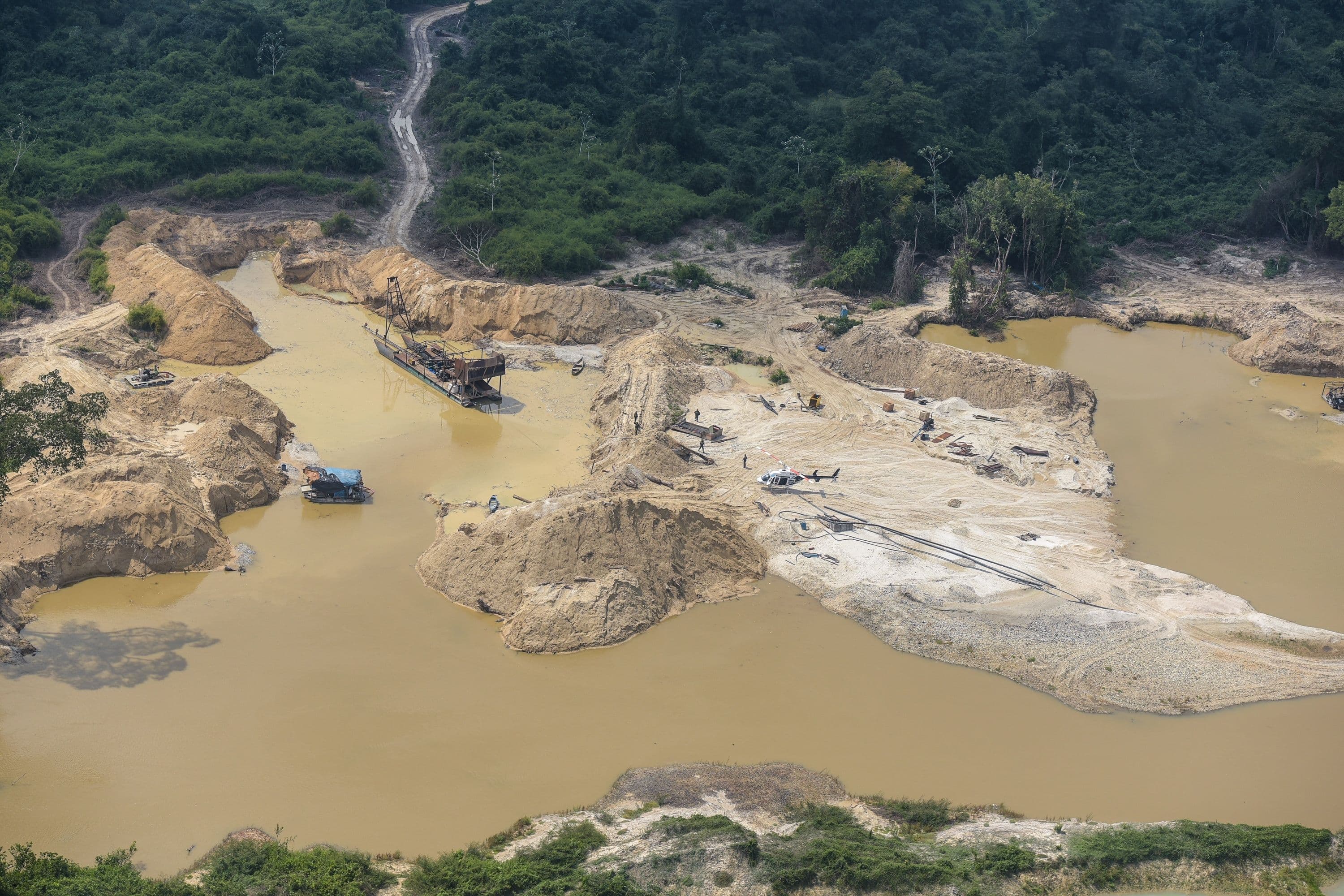
The expansion of garimpo in the Amazon was more intense in indigenous territories
The expansion of garimpo in the Amazon was most intense in protected areas, such as indigenous territories and Conservation Units. Between 2010 and 2021, the areas of mining in indigenous lands grew 632%, occupying almost 20 thousand hectares last year. The most exploited indigenous land was the Kayapó, where 11,542 hectares have been taken over by mining until 2021. Next comes the Munduruku territory, with 4,743 hectares, the Yanomami land, with 1,556 hectares, the Tenharim of Igarapé Preto, with 1,044 hectares, and the Apyterewa territory, with 172 hectares.
Garimpo increased 352% inside Conservation Units between 2010 and 2021. The historical series shows that the area occupied until 2010 was less than 20 thousand hectares. In 2021, it was already almost 60 thousand hectares. Of this total, almost two thirds are in the Tapajós APA, where mining already occupies 43,266 hectares. In second place is Amanã National Forest, with 5,400 hectares, followed by Crepori National Forest (1,686 hectares), Rio Novo National Park (1,637 hectares) and Jamari National Forest (1,191 hectares).
Differences between garimpo and industrial mining
In all, the Amazon concentrated 242,564 hectares of mined area (that is, adding garimpo and industrial mining) in 2021. In the case of the Atlantic Forest, this total is 63,892 hectares; in the Cerrado, 46,070 hectares. The lead of the Amazon remains when we analyze only garimpo, with 179,913 hectares. The Cerrado is in second place, with a distant 13,253 hectares; the Atlantic Forest, in turn, concentrates 2,299 hectares.
In the case of industrial mining, the situation is different. There is almost a balance between the area occupied in the Amazon (62,650 hectares) and in the Atlantic Forest (61,593 hectares). Another 32,817 hectares are in the Cerrado. The difference is Minas Gerais, the state that leads the industrial sector, with almost half (46.9%) of the national total, or 61,181 hectares. The other states with the largest industrial mining areas are Pará (42,216 hectares), Goiás (11,606 hectares), Amazonas (8,166 hectares) and Bahia (7,442 hectares). Together, Minas Gerais and Pará account for 79.2% of the Brazilian industrial mining area.
Industrial mining and garimpo also differ in relation to the mineral substances exploited. While industrial mining has a more diversified focus (Fe, Al, Cu, Ni and others) garimpo is concentrated on a few substances (Au and Sn): 83% of the area occupied by garimpo is related to gold extraction and 7% to tin. In the case of industrial mining, 22% of the area is iron mining, 20% aluminum and 12% limestone.
About MapBiomas: a multi-institutional initiative, involving universities, NGOs and technology companies, focused on monitoring the transformations in the coverage and use of the land in Brazil, to seek conservation and sustainable management of natural resources, as a way to combat climate change. This platform is today the most complete, up-to-date and detailed spatial database of land use in a country available in the world. All data, maps, methods and codes from MapBiomas are publicly available and are free on the initiative's website: mapbiomas.org.