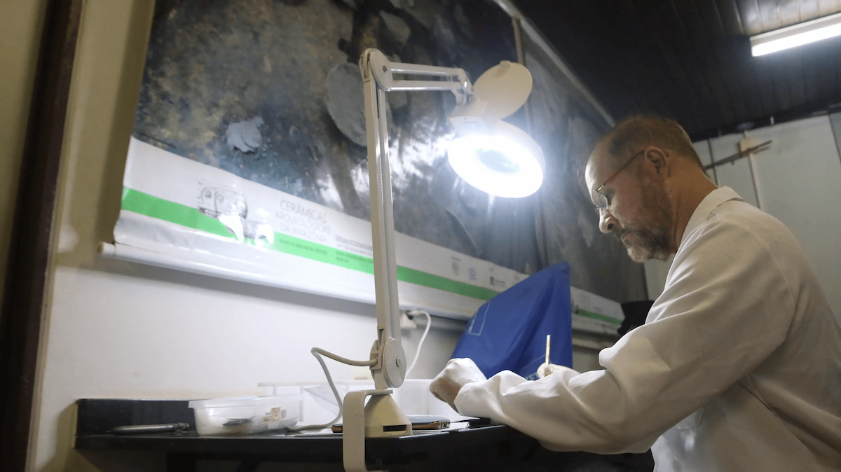
Of the five Brazilian states which deforested the most along 2021, four of them are located in the Amazon. The region is responsible for the felling of about 18 trees per second and the states occupying the first and second positions in the rank of destruction are, respectively, Pará and Amazonas. These are data from the Annual Deforestation Report, published last July by MapBiomas, a collaborative network formed by Non-Governmental Organizations (NGOs), universities and technology startups. The report analyses, consolidates and validates all deforestation warnings in Brazil, identified by monitoring systems.

According to Larissa Amorim, a researcher at Amazon Institute of People and the Environment (Imazon), the illegal mining activity in the forest is one that has grown and advanced the most in recent years, even in protected areas of the Amazon, such as conservation and indigenous lands. In Pará, in fact, are the largest mining areas in indigenous territories (Kayapó and Munduruku lands) and, among the ten conservation units where the greatest mining activity has been identified, eight are within the state of Pará.
The researcher is a member of the Amazon Monitoring Program and emphasizes that the deforestation scenario has worsened in recent years – a significant setback when compared to the improvements implemented, especially in the first decade of the 2000s. According to the researcher, a good example of the recent past was the period between 2005 and 2012, “when government and private sector actions managed to reduce the national deforestation rate by 83%.”
Larissa Amorim emphasizes the importance of strengthening bodies, such as Ibama and ICMBio and resuming government measures, such as the Action Plan for the Prevention and Control of Deforestation in the Legal Amazon (PPCDAm), which aimed to reduce deforestation rates, creating conditions for sustainable development in the region; and Amazon Fund, which received donations for non-reimbursable investments in actions related to preventing, monitoring and combating deforestation.
Listen to the comment on this news:
Farming practices have high impact on forests
Deforestation has not occurred in most properties registered in the Sistema Nacional de Cadastro Ambiental Rural [Federal Government's National Rural Environmental Registry System] (CAR), however, the percentage of less than 1% which have registered deforestation, is responsible for much of the devastation identified by the MapBiomas report: 97.8% regarding deforested areas in the last three years and agricultural and cattle raising activities were the vectors.
According to Luis Oliveira Junior, a researcher at Imazon and technical coordinator in the Amazon biome team, in the MapBiomas network, this trend has also been observed in past decades. The researcher reports that between 1985 and 2020, in the Amazon biome, approximately 44 million hectares of forest were lost and agricultural management replaced 99% of the lost forest areas. “It is worth mentioning that part of these open areas is abandoned and not actually in use, as they are the target of real estate speculation”, he explains. “Land invaders ('grileiros') have illegally taken public lands, deforested them and put cattle on these areas to indicate a productive use. It is therefore necessary to remove and punish these invaders and allocate public forests that have not yet been used for the creation of new protected areas, such as indigenous lands, quilombola territories or conservation units”, he adds.
The researcher also emphasizes that it is necessary to increase the productivity of livestock in the Amazon, to combat the devastation of forests. “On average, there is 1 animal per hectare in the region, however, the ideal ratio would be at least three. The solution involves several actions, including effectively tracking and inspecting cattle and providing incentives for the recovery of degraded pastures”, explains Oliveira Junior.
There are also other solution measures proposed by the Imazon researcher such as: providing broad access to continued technical assistance, making rural credit conditional on increasing productivity in a sustainable way and investing in infrastructure in priority areas. “It is also important to have data transparency, so that we can understand the complex meat chain. Currently, there is no guarantee of meat origin not linked to deforestation”, he adds.
The Liberal Amazon report contacted the Confederation of Agriculture and Livestock of Brazil (CNA), seeking to schedule an interview or receive a position by note. However, until the closing of this edition, he had not received a return from the entity.

Indigenous peoples have essential role in the preservation of forests
Indigenous lands (TIs) were also affected by deforestation, especially in the Amazon and markedly in Pará, which is home to the five TIs that concentrate 45% of deforestation records in this type of territory in Brazil, in 2021: Apyterewa, Trincheira Bacajá, Cachoeira Seca, Kayapó and Ituna Itatá.
As serious as the damage is, this amount represents less than 2% of total deforestation in Brazil. And, according to data from MapBiomas, the control of the devastation progress is due to the strong action of indigenous peoples in the territories. “Satellite data leaves no doubt that it is the indigenous peoples who are delaying the destruction of the Amazon rainforest. Without their territories, the forest would certainly be much closer to its tipping point, from which it ceases to provide the environmental services on which our agriculture, our industries and cities depend”, explains Tasso Azevedo, general coordinator of MapBiomas, in interview published on the project website.
In the last 30 years, indigenous lands lost only 1% of their native vegetation area, while in private areas the loss represented 20.6%. Currently, indigenous lands occupy 13.9% of the Brazilian territory and contain 109.7 million hectares of native vegetation, which corresponds to 19.5% of the native vegetation in Brazil in 2020.
Conservation Units - In Conservation Units (UCs), with special characteristics that guarantee the protection of their lands by law, 166,895 hectares of trees were felled in 2021. These figures represent 10.1% of the total deforested area in Brazil.
The two units with the largest deforested area in the country are in the state of Pará: Environmental Protection Area (APA) of Triunfo do Xingu, with 48,971 ha, and Floresta National Forest (FLONA) of Jamanxim, with 18,281 ha.
Illegal activities and impunity prevail
The Deforestation Yearly Report also analyzed the actions concerning prevention of illegal deforestation carried out by Chico Mendes Institute for Biodiversity Conservation (ICMBio) and the Brazilian Institute for the Environment and Renewable Natural Resources (Ibama). Only 2.4% of the deforestation cases reported between 2019 and 2021 suffered some kind of embargo or fine payment until May 2022. This record evidences lack of inspection and punishment regarding deforestation crime in Brazil. Furthermore, the Report indicates that more than 98% of deforestation cases in the country have some level of illegality.
For the Federal Attorney Daniel Azeredo, coordinator of the Amazônia Protege Project, led by the Federal Public Ministry (MPF), more strictness is necessary on the application of the existing legislation that protects the forests. “We need to fight impunity. Violators must see that profitability cannot be over legislation, that illegal deforestation is not the best way,” he states. According to Azeredo, the legislation determines several penalties in the event of illegal deforestation, such as loss of land, compensation and prohibition of production in these areas.
The Liberal Amazon reporters also contacted ICMBio and IBAMA, however, no return from both institutions was received until this edition was finished.
By the end of this reading, more than 15,000 trees will have been felled in the Brazilian Amazon
Satellites play important role for surveillance
According to attorney Daniel Azeredo, one of the challenges in combating deforestation in the Amazon is that there are not enough public workers for inspection, due to the territorial extension of the region. For this reason, satellites are currently being used to inspect the region, through a project named Deforestation Monitoring Project in the Legal Amazon (Prodes/Inpe).
Thus, the in-person inspection by IBAMA is combined with the analysis of satellite images. Sequentially, the MPF receives the images and registers areas of illegal deforestation, through the Amazônia Protege project. Afterwards, IBAMA analyzes the images, comparing the information with public databases and publish reports confirming the illegal deforestation case. “It follows the same logic as speed cameras. Detran (Traffic Department) does not have enough employees to be at all points on the highways, so they use images to be able to expand monitoring capacity. That's what we do with satellite images,” explains Azeredo.
In addition to facilitating inspection, the use of satellites costs less for the public budget. Also, the processes are faster and guarantee more evidences for when a lawsuit is filed against those who deforest illegally, because the remote evidence that is captured by the images can demonstrate what an area was like before and after a certain moment, clearly demonstrating when there was deforestation. “Nowadays, we are able to file lawsuits only based on satellite images and public data,” adds the attorney, referring to a decision by the Superior Court of Justice that, since 2020, has approved the conviction of defendants for deforestation based on evidence remotely obtained.
The Deforestation Monitoring in the Legal Amazon Project has been taking place since 2017 and the MPF expects it to help to move the lawsuits faster and provide more punishment for the illegal deforestation cases. These are fundamental aspects, since, according to Imazon, only 8% of the actions carried out by the MPF to combat deforestation in the Amazon resulted in punishments between 2017 and 2020.

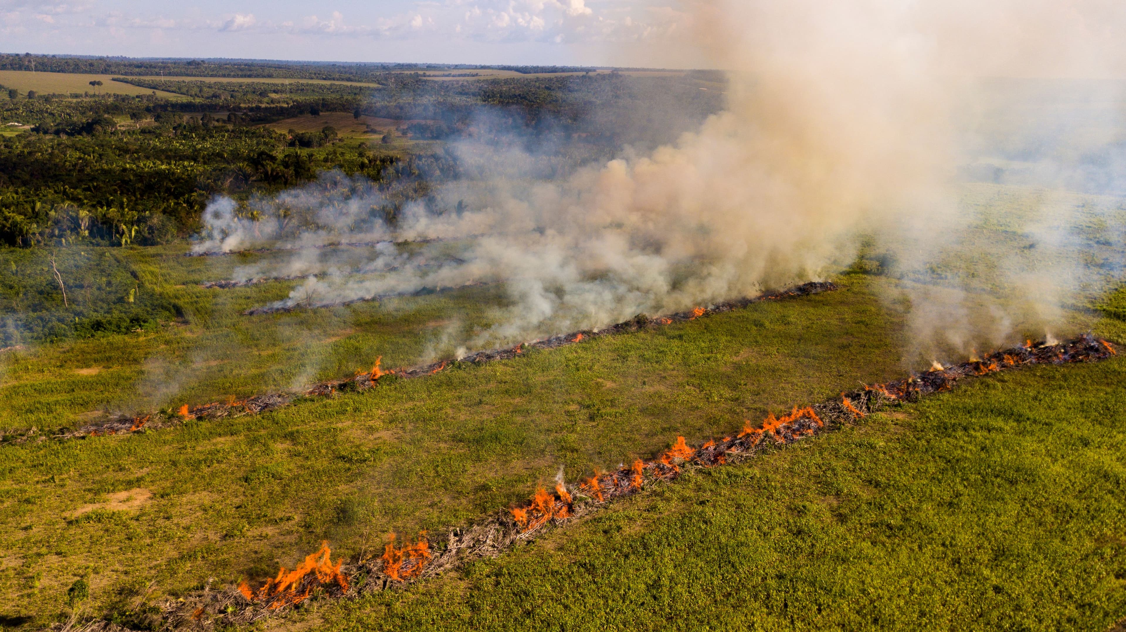
In 24 hours, deforested area is equivalent to thousands of soccer fields
In 2021, the date when the rate of deforestation in the Amazon was the highest was on July 11th , when 4,143 hectares of forest were cut down in 24 hours, that is, the equivalent to more than 4 thousand soccer fields.
According to Larissa Amorin, from Imazon, “the deforestation rates are higher during this period [Amazon summer], because it is “easier” to deforest during the dry season, and the detection of deforestation through satellite images is also problematic during the rainy season due to the presence of clouds”.
See below data that prove Amazon as being the biome which underwent greater native vegetation loss, in 2021:
● More than 977 thousand hectares of native vegetation destroyed;
● Increase by almost 15% in relation to the 851 thousand hectares deforested in 2020, which, consecutively, had already represented a 10% increase in relation to the 771 thousand hectares of deforestation in 2019.
| States with the highest deforestation rates in Brazil/ Numbers in hectares (ha) | |
| Pará | 402,492 ha (24.3%) |
| Amazonas | 194,485 ha (11.8%) |
| Mato Grosso | 189,880 ha (11.5%) |
| Maranhão | 167,047 ha (10.1%) |
| Bahia | 152,098 ha (9.2%) |
Source: MapBiomas - Yearly Deforestation Report
| Municipalities with the highest deforestation rates are in the Amazon / Numbers in hectares (ha) | |||
| Altamira (PA) | 63,840 ha | Apuí (AM) | 35,448 ha |
| São Félix do Xingu (PA) | 52,701 ha | Itaituba (PA) | 30,174 ha |
| Lábrea (AM) | 49,345 ha | Coiniza (MT) | 22,656 ha |
| Porto Velho (RO) | 49,173 ha | Portel (PA) | 21,565 ha |
| Novo Progresso (PA) | 37,229 ha | Humaitá (AM) | 18,309 ha |
Source: MapBiomas - Yearly Deforestation Report