Brazil is the largest country in South America, with an impressive area of 8,514,004 km². This giant nation also covers the largest portion of one of the most important biomes on the planet: the Amazon. It covers 6.7 million km², 60.1% of which belongs to the Brazilian territory. All this geographic grandeur is, today, well delimited by 16,886 kilometers of borders. What few people know is that these limits represent the result of the work of men and women who ventured into the most challenging terrains to demarcate the national territory. It is the effort of the members of Primeira Comissão Demarcadora de Limites (PCDL) [First Limits Demarcation Commission].
PCDL is a body linked to the Ministério das Relações Exteriores (MRE) [Ministry of Foreign Affairs], headquartered in Belém, capital of Pará, created in 1928 to undertake the challenge of demarcating the borders in the North of Brazil. Another similar body, Segunda Comissão Demarcadora de Limites (SCDL) [Second Limits Demarcation Commission], based in Rio de Janeiro, was created with the same purpose, focused on the Southern borders.
The PCDL is responsible for the Northern Border, the largest operational area of the Ministry of Foreign Affairs in South America, with 9,767 kilometers in length, neighboring Peru, Colombia, Venezuela, Guyana, Suriname and the Department of French Guiana – representing 57.8% of the country's total borderland strip. The state of Pará, a direct neighbor of Guyana and Suriname, has its borderland extension stretching along 2,119 km, equivalent to 21.6% of the Northern Border.

Since the first demarcations made in the 1930s, the PCDL now has achieved 6,642 landmarks installed along the border. These landmarks are surface and/or underground concrete structures, which establish the border between countries. Today, these lines delimit and guarantee Brazilian sovereignty over the territory it occupies. However, when the PCDL was created, they were still in the demarcation process, as recalled by the current head of the PCDL, Dauberson Monteiro da Silva: "In former times, demarcations were carried out by non-permanent commissions. Once a service was assigned, a delegation was constituted and, as the work finished, the commission was dissolved. The PCDL was created to act in permanent basis on January 27, 1928, when Brazil was still in the demarcation process".

Dauberson explains that the demarcation process takes place in four stages: negotiation between countries, carried out by diplomats; delimitation of borders, with the definition of limits established on maps; the treaty, which is the description of the limit with international recognition; and the demarcation, constituting the characterization of these limits through the implementation of physical landmarks.
For the head of the PCDL, the fact that Brazil is one of the few countries in the world with all borders delimited peacefully, without conflicts with neighbor nations on the continent is a source of pride. “Brazilian limits, almost 17 thousand km of land borders, are consolidated. There is no dispute between Brazil and its neighbors”, he states.
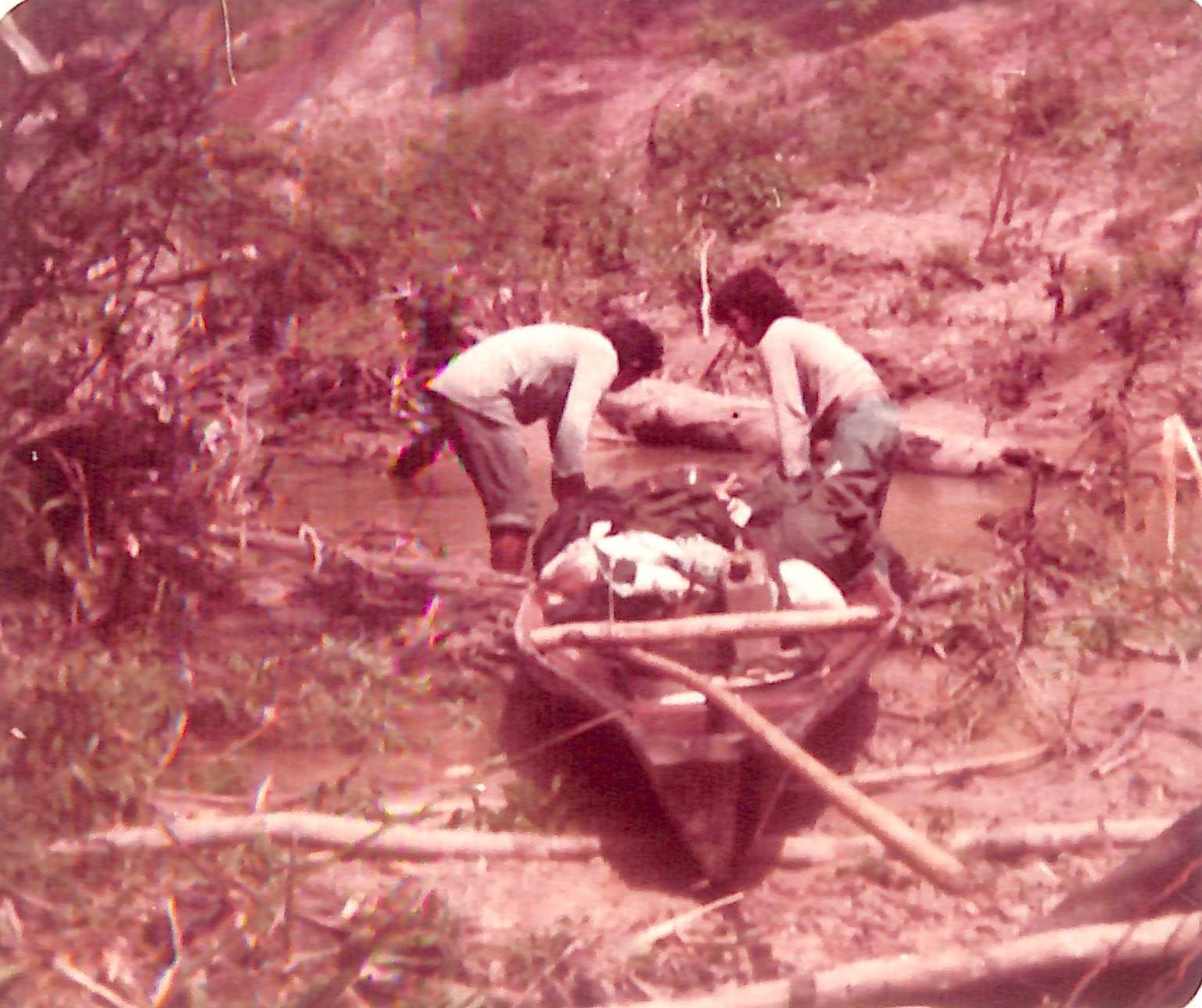
This was, actually, a practical work accomplished by hundreds of workers who, from the 1930s to the 1970s, committed themselves to traveling to the most distant parts of Brazil to place territorial landmarks.
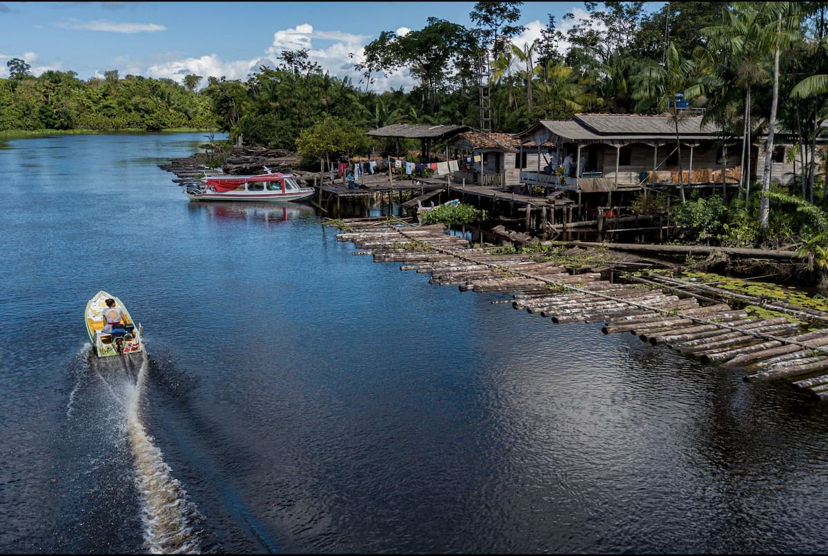
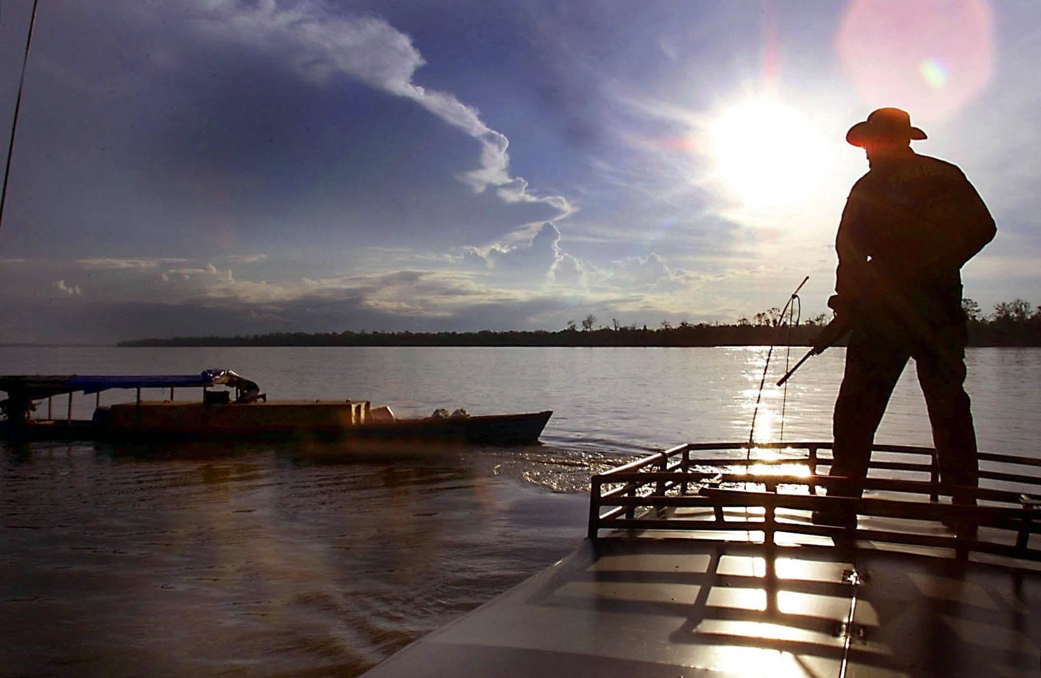
The Brazilian demarcation process began at a time when there were no precision technologies, such as GPS, leading teams to use the position of the stars to locate themselves and explore paths – usually a hard work due to the natural challenges of the Amazon biome such as the large rivers and dense forests.
“The travel experience was justified by the fact that we worked on a boat. We left from Belém on the Navy ship to Manaus and, from Manaus, to São Gabriel da Cachoeira, in Amazonas. It was an extensive trip”, says Pedro Barbosa dos Santos, 84, PCDL leader since the end of the 1950s.
“We started there by boat, canoe, we went hiking in the forest, everything. And I participated in actions on all these borders – sometimes more, others less. Venezuela, Colombia, Peru. I spent five, six months at the border”, recalls veteran Pedro Barbosa dos Santos.
Land surveyors embarked on adventures to fulfill a mission
Of all the steps involved in consolidating borders, demarcation was the most challenging one in practical terms, as it required a technical team to go to the most extreme points of Brazilian territory to implement a territorial landmarks. These trips demanded courage, availability and determination from PCDL members to carry out the mission.
This is because the demarcation processes in Brazil began at a time marked by the absence of precision technologies, such as GPS, meaning that teams needed to use the position of the stars in the sky to locate themselves and explore paths – usually a hard work due to the natural challenges of the Amazon biome such as the large rivers and dense forests.
This is what says the report presented by Pedro Barbosa dos Santos, a member of the PCDL land demarcation team since the end of the 1950s. Currently, at the age of 84, the retired man remembers, with some difficulty due to his advanced age, what his activity period was like: “At that time, we were guided by astronomy. We had people with ability to do this. There were times when we spent up to eight days learning the correct positioning. It wasn't very easy. But our devices were those available to do the job at the time,” he comments.
Pedro Barbosa regrets that part of his travel records was lost during a storm that caused part of his house to collapse, in Belém, while he was on one of his trips. According to what he can still remember, Pedro says that one had to be under 32 years old to join the demarcation trip. It was necessary to be “strong and healthy” to face the challenges. He also talks about the route taken at the beginning of the trip: “The travel experience was justified by the fact that we worked on a boat. We left here from Belém on the Navy ship to Manaus and, from Manaus, to São Gabriel da Cachoeira, in Amazonas. It was an extensive trip”, it used to take days for us to arrive. This was in the times of General Bandeira Coelho”, he comments.
The land surveyor reports that the commission was large. PCDL employees, who traveled from Belém, met with other workers in the municipality of Óbidos and, from there, they went to the state of Amazonas to demarcate the borders with Colombia and Venezuela, for example.
“We started there traveling by boat, canoe. We used to go hiking into the forest. And I participated in actions on all these borders – sometimes more, sometimes less. Venezuela, Colombia, Peru. I spent five, six months at the border”, recalls the veteran.
After the creation of more precise technology for positioning landmarks on the border, it also became PCDL's responsibility to update the geographical coordinates of landmarks placed in previous decades by the first land surveyors.
“An astronomical spot has a margin of error of approximately two or three hundred meters. It does not mean that the landmark was wrongly positioned. It means that the coordinates at the time, which were obtained using this method, were not accurate”, explains technical advisor Edivaldo Campos da Silva.
Edivaldo Campos da Silva also explains that the old landmarks are not moved. Updating the coordinates serves to improve cartography.
“We are one of the first in South America to use drones for mapping”, says Edivaldo Campos da Silva
In the last century, 622 landmarks were installed on the Northern Border. After that, another 6,020 landmarks were included in the densification process – a process that occurred mainly on the borders with Peru (11 landmarks included), Colombia (144) and Venezuela (3,045).
Technology advances to the frontiers
Technical advisor Edivaldo Campos da Silva has been in charge of several field trips since he started working at PCDL in 1995. He deeply experienced the reality using the most archaic instruments, however, at this time, there were technological improvements that in addition to making work in the field easier, also expanded the current functions of the PCDL.
“GPS arrived in 1987, but it didn’t have the precision it has today. It was accurate allowing three meters of error. After 1995, GPS technological devices with today's precision were created. So, when I arrived here, it was easier to determine positioning”, says the employee.
With the arrival of more precise technology for positioning landmarks on the borderland strips, it also became PCDL's responsibility to update the coordinates of old landmarks, placed in previous decades by the first land surveyors. Edivaldo says this is an important work for the cartography of the present and the future.
“An astronomical spot has a margin of error of approximately two or three hundred meters. It does not mean that the landmark was wrongly positioned. It means that the coordinate at the time, which was obtained using this method, was not accurate. However, when a GPS device is placed on the same landmark, it informs the precise coordinate. Thus, one of our tasks today is to go into the field and update this coordinate.”
Edivaldo also emphasizes that the old landmarks are not moved from their places. Once established by the first land surveyors, there they remain. But updating the coordinates helps improving cartography – a more accurate drawing of the position of these dividers on the country's maps.
In addition to GPS, other technologies have brought modernity to the work: “Today we are using drones for mapping, especially in border cities, because it is easier to arrive at places. We are one of the first in South America to use drones for mapping. We’ve been doing this for about five years now,” he comments.
Another important task of the PCDL today is the densification of borders, that is, the work of implementing new territorial landmarks among those established by the first land surveyors, in order to shorten the distance between the landmarks and better delimit the border, as highlighted by the current head of PCDL, Dauberson da Silva: “Densification means the inclusion of new landmarks where we consider necessary. Normally, in the land sections where the population is growing, in border areas or regions that require better characterization of the limits, new landmarks are built, intermediating the main ones.
We have few border cities in the North: Assis Brasil, in Acre with Peru; Cruzeiro do Sul also in Acre; Tabatinga, in Amazonas; Pacaraima, in the north of Roraima; Bonfim, on the border with Guyana; and the city of Oiapoque with France”.
According to PCDL data, during the demarcation period in the last century, 622 landmarks were installed on the Northern Border, establishing the country's limits. After that, another 6,020 landmarks were included in the densification process – a process that occurred mainly on the borders with Peru (11 landmarks included), Colombia (144) and Venezuela (3,045).
“This experience revealed to me the real value of the material I was storing and caring for, here, for posterity. Participating in History". says Ivete Castro Botelho.
"One of the criteria for choosing my degree was precisely the little presence of women and whenever there's an obstacle, or something like that, I find it very interesting” says the engineer, cartographer and land surveyor Gabriela da Silveira Mesquita, the first woman to be part of a land demarcation team.

Female presence on the border
Ivete Castro Botelho is another PCDL employee who, in addition to having had field experiences at the borders, is also a guardian of the Commission's memories.
Graduated in Librarianship, Ivete says that when she started working at PCDL in 1993, she had no idea what she was about to experience.
"I started with the expectation of working in the library, serving the public, among other things. But when I got here thigs were different. I had to open the library, which was not yet accessible to the public. Right from the start, we realized that the material was very specific to those doing undergraduate or master's degrees, etc."
She says that, in her first year of service, a meeting was held to decide on the participation of women in demarcation delegations – something that had been authorized in 1987 for the first time when officials Eliete Gillet Brasil, Jamile da Fonseca and Roseli Alves Pronk pioneered female presence in demarcation delegations. However, according to Ivete, a period followed without women travelling in delegations.
"In the first meeting to check how the service was evolving in each sector, one of the issues was women's participation in the missions, as they hadn't been travelling for a while. There was a vote, and one of the votes was mine, and it was approved that women continue to go to missions. The following year, in 1994, it was my first mission."

Ivete reports she had no idea what lay in store for her, but she fell in love with the adventures in the field. "We went to the border with Venezuela. We went to Boa Vista, then by bus to Pacaraima, where we met the Venezuelan commission, and went on to San Antonio, a place near the last border town with Venezuela. A really big and improvised camp, made of blue canvas. Everything caught my eye: setting up the camp, the kitchen in the middle of the forest" she mentions about her first trip.
On her trips, Ivete recalls that she used to be assigned the role of "suprida", a position in which she was responsible for managing the commission money and buying supplies. "I was responsible for paying for all the material that was purchased, for paying the workers, what money came in and what money went out. I did it in the morning, so in the afternoon I had free time and was ready to do anything. From setting up a table to crossing a river, checking the “picadas” [trails], which were paths through the forest - I did it all."
Ivete’s experience in the field was fundamental for her work with the PCDL's historical records. She points out: "This work gave me an idea of the material I had in my hands, because until then I didn't even really know what the demarcation was like. So, I began to value the work even more, as Itamaraty produces and is the guardian of its own material, its own memory. This experience revealed to me the real value of the material I was storing and caring for, here, for posterity. Participating in History".
The first female land surveyor
Since women began going into the field on demarcation trips in 1987, it took 35 years for the PCDL to have the first woman on staff, in formal terms. It wasn't until in 2022 that the Commission had a female land surveyor with academic formation in the area – the 27 year-old engineer, cartographer and land surveyor Gabriela da Silveira Mesquita.
Gabriela started working at PCDL a year ago and says she was surprised when she found out she was the first woman with professional training to work in border demarcation: “I always thought there were other women. That was until the day I went on my first campaign in Colombia and people were saying 'wow, a woman on the team'. And I was treated very well, always with respect. In my second campaign, they said 'let's toast the first female land surveyor'. That's when I realized that I was the first educated woman to work in the field.”
The professional says she has always enjoyed overcoming challenges, for this reason, since her technical training, she has been looking for areas in which women’s presence was uncommon.
"One of the criteria for choosing my degree was precisely the little presence of women and whenever there's an obstacle, or something like that, I find it very interesting," she says.
Today, Gabriela understands she has a representative role as the PCDL's first female land surveyor, an achievement she hopes will reflect positively on future generations: "It's a responsibility. We're a bit 'on the ball', trying to keep a line, being as coherent as possible in order to always represent women well in the profession. And, also, to encourage more women to occupy these spaces".